Design of guide plates for the Lake Biwa Canal 琵琶湖疏水案内板デザイン
扁額案内板デザインについて about Guide Plates of 6 tablets(map 1~6)
案内板のデザインに着手した2009年当時、上下水道局は琵琶湖疏水の維持管理で手いっぱいで、疏水をトータルに国内外にPRする余裕はなく、看板業者に発注する従来の手続きを踏襲しようとした。それを示すのは以下の見積書である。
When I was engaged in design of guide plates of 6 tablets in the summer 2009, the Waterworks Bureau of Kyoto City had neither idea nor enough money for public relations of Lake Biwa Canal which needs a lot of maintenance works. So they had intended to follow the traditional way of ordering to a signboard manufacturer. At the end of August 2009, I had received the paper of estimation as below.
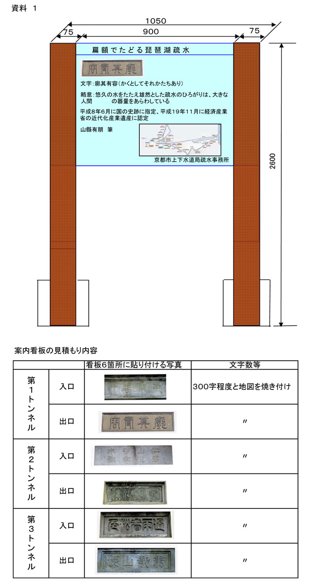
当初の依頼は、上記のように、90cm四方のプレートに図版と解説文・既存の地図をレイアウトすることだった。
これに対して、バイリンガル表記とすること、疏水全体の新しい地図、現場詳細図、トンネル断面のシルエット等によるヴィジュアル面の強調を提案し、疏水事務所長ほかの賛同を得て採用された。中間業者を介さず、デザインと印刷・施工のみで、経費も抑えた。
こうしてできあがったのが、現在設置されている案内板である。
Originally I was asked the layout of Jananese explanation and the photography of the tablet on the plate of 90cm square, but I proposed the bilingual one and the improvement of visuality with new design of map and silhoutte of the section of the tunnel.
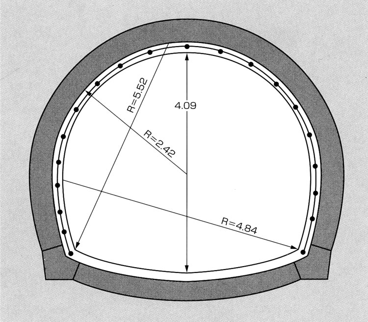 トンネル断面図 section of the tunnel
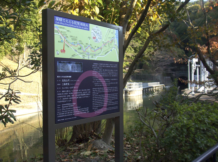
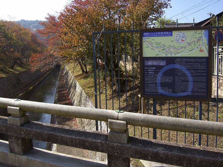 第1トンネル入口扁額案内図 設置状況 installation view of the Guide Plate on the entrance of the First Tunnel
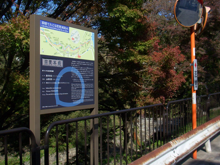 第1トンネル出口扁額案内図 設置状況 installation view of the Guide Plate on the exit of the First Tunnel
 第3トンネル出口扁額案内図 設置状況 installation view of the Guide Plate on the exit of the Third Tunnel
第一竪坑について about the First Pit Shaft(map 7)
第一竪坑は、琵琶湖疏水建設の第一の要であった。
重機のない当時、2.4kmを越える当時日本最長の第一トンネルを直接掘削することは不可能であり、設計者の田邉朔郎は、途中に垂直の竪坑を掘り、東西に掘り進めることで第一トンネル開削を実現した。竪坑方式は日本初の試みであった。しかし人力で深さ47mもの竪穴を掘ることは困難をきわめ、工事は17名以上の殉職者を伴った。だが、この第一竪坑なければ第一トンネルはなく、第一トンネルなければ琵琶湖疏水もなかった。そして琵琶湖疏水が古都・京都の近代化を導いたことはいうまでもない。
その意味で第一竪坑は、近代都市・京都の「垂直の産道」といえる。だがこの事実はほとんど知られていない。
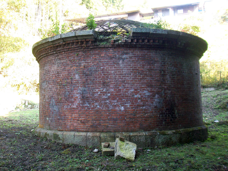
竪坑の地上部は長く放置状態にあり、一部に崩落もあって立入禁止の措置がとられていた。
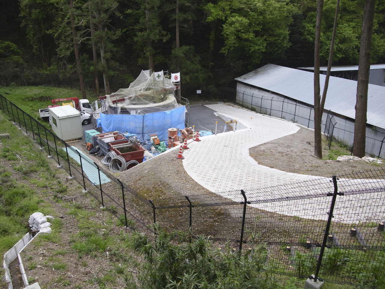
2012年にようやく改修と敷地整備が始まったが、敷地とともにまだ一般公開される状態に至っていない(2021年6月現在)。
The First Pit Shaft is the pivotal point of the construction of Lake Biwa Canal.
In Meiji era, it was impossible to dig the first tunnel of 2400m by hands, so they digged a vertical pit just on to the tunnel route to dig the tunnel to both east and west end. But it was also difficult to dig vertically a pit of 47m depth by only human power, so more than 17 workers were died.
However if the First Pit Shaft had not been realized, the first tunnel would not be completed, and if the first tunnel had not been realized, the Lake Biwa Canal which led the city of Kyoto to a modernized city would be realized.
So we can say that the First Pit Shaft is a "vertical birth canal" of modern city of Kyoto. But few know this historical fact.
For a long time, the First Pit Shaft had been abandoned and the approach had been prohibited.
At last in 2012, the restoration was started, but it has not yet been open to the public. (June 2021)
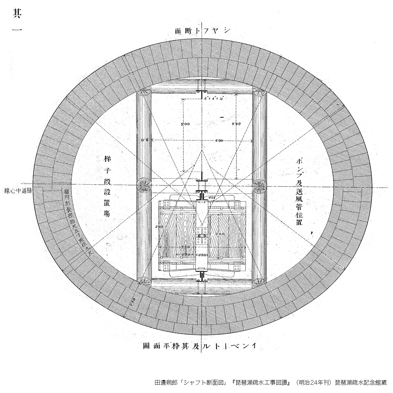 image of the section of the First Pit Shaft ( --> Sakuro Tanabe's plan )
2009年
 竪坑地上部。長く放置され、一部崩落していた。2009年11月8日撮影。
First Pit Shaft damaged. photography: Akihiko Inoue, november 8,2009
2012年
 竪坑がようやく修復される。敷地も一部整備された。2012年5月5日撮影。
First Pit Shaft restored, photography: Akihiko Inoue, may 5, 2012
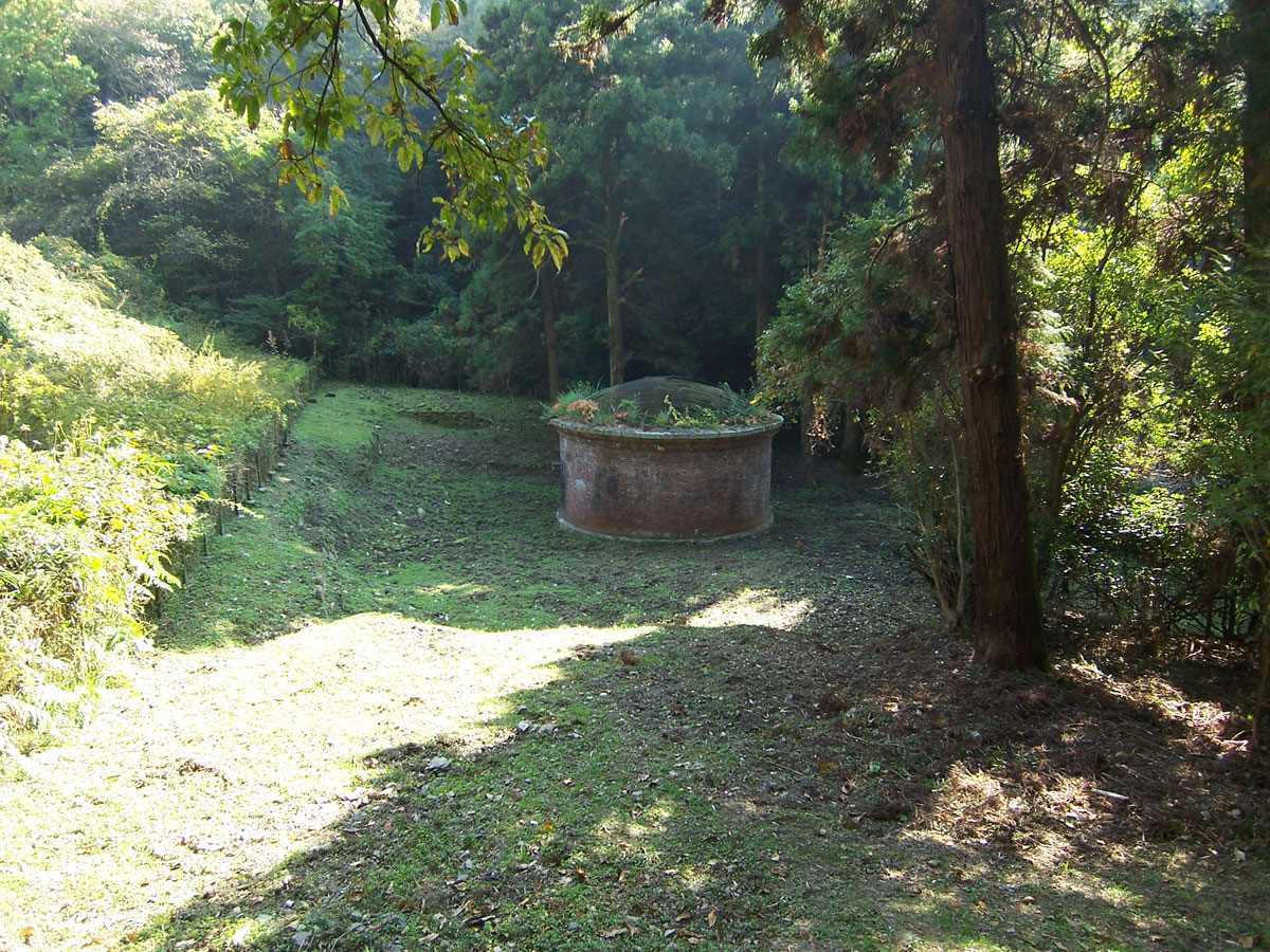
2018年
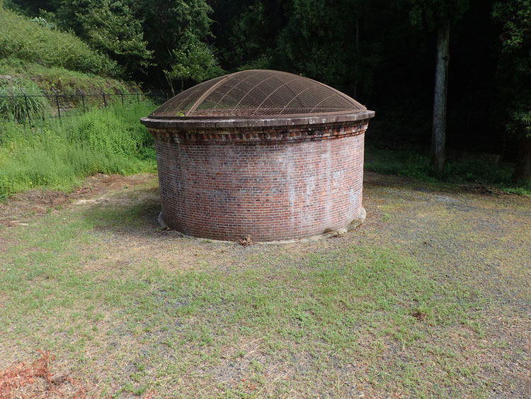 修復された第一竪坑(地上部)。だが諸般の事情でまだ一般には非公開。(2018年8月23日撮影)
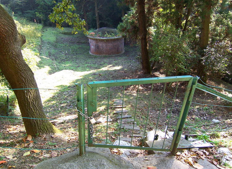
アクセスが悪く、周辺が未整備なため、竪坑跡に近づくことはできない。
だが第一竪坑の根本的重要性を考えれば、アプローチ含めたサイト全体の早急なリデザインが望まれる。
First Pit Shaft was restored but not yet open to public. photography: Akiiko Inoue, August 23,2018
蹴上インクライン三十石船案内板 Guide Plate of Keage Incline(map 8a, 8b)
『京都新聞』web版 2014年11月9日の記事
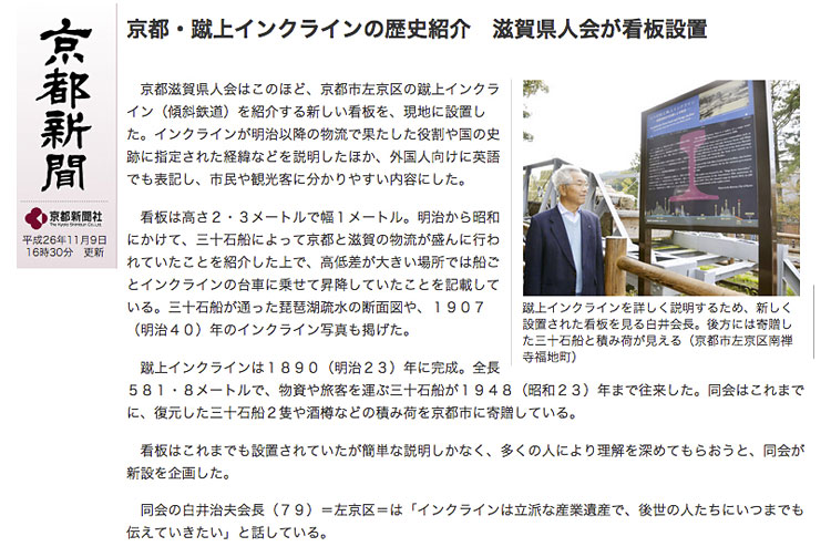
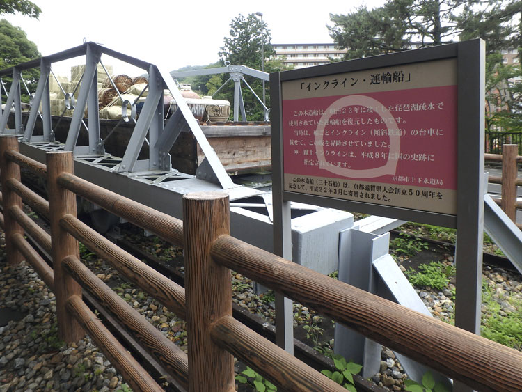 新しい案内板のデザインに先立って、現地に扁額案内板のデザインを模倣した看板が設置されていたことを知った。
トンネル断面図のシルエットが誤って配されている。残念ながら同じ体裁の看板がインクラインの上にもそのまま残っている。
京都市職員のデザインの認識とはこのようなものであることを悲しく思う。
四宮船溜案内板 Guide Plate of Shinomiya Dock(map 9)
2017年、案内板デザインの委嘱担当は、技術系の疏水事務所ないし施設課から事務系の総務課に代わった。
2015年以来の疏水クルーズ復活による観光振興とそれに対応する上下水道局内の体制変化が背景にある。
ただし2017年秋の時点では、案内板設置は洛東ロータリークラブが出資し、京都市が寄附受納する、というかたちを取っていた。まだ疏水観光の運営体制が整っていなかったのである。「琵琶湖疏水沿線魅力創造協議会」による疏水通船の正式運航は2018年3月末に始まる。
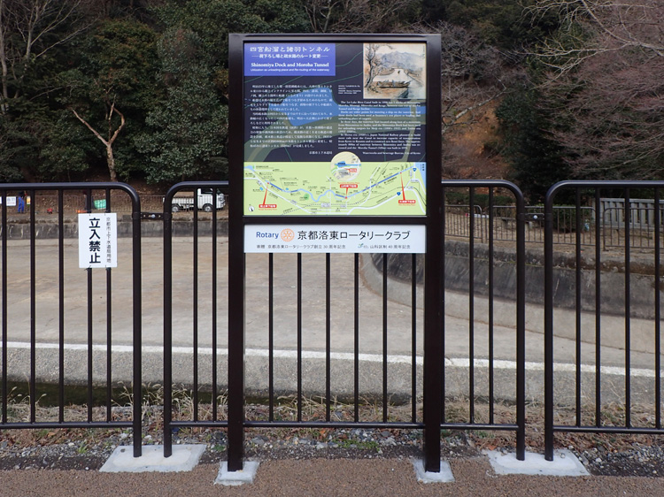 出資者の洛東ロータリークラブの名札がつけられた案内板。
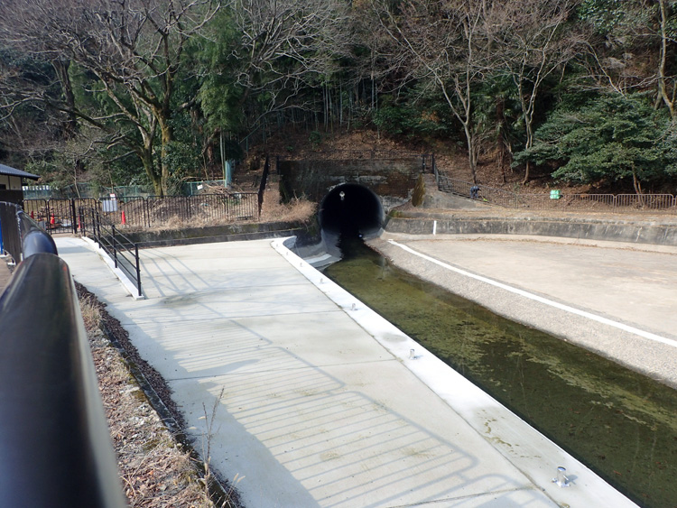 観光船の乗船場として改築された四宮船溜。奥に見えるのは諸羽トンネル(1970年開通)。
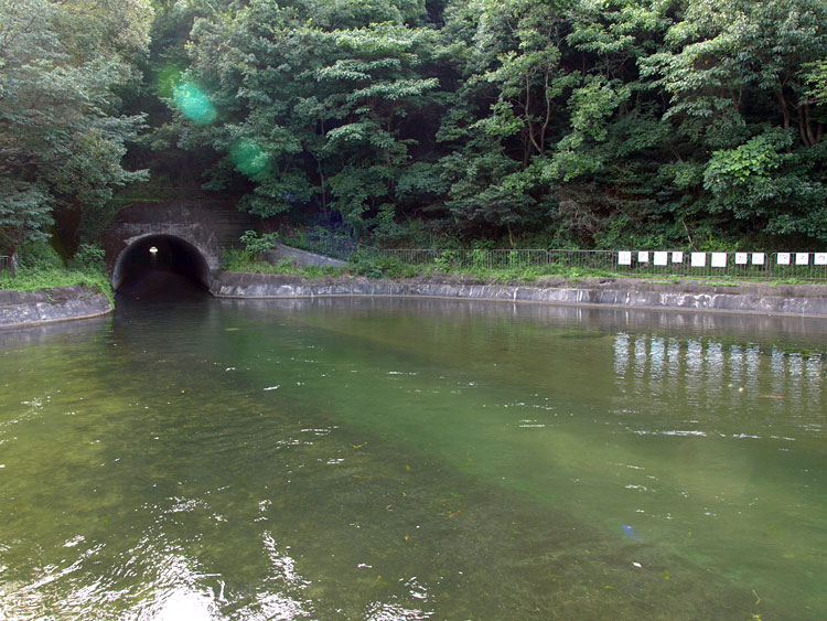 かつての四宮船溜。2009年8月12日撮影。
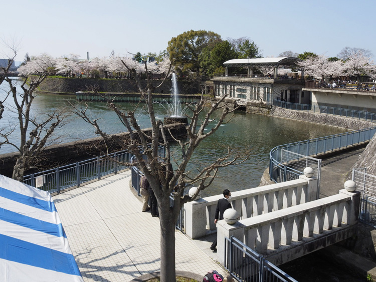 南禅寺船溜とドラム工場(奥) Nanzenji Berth and the Drum Plant
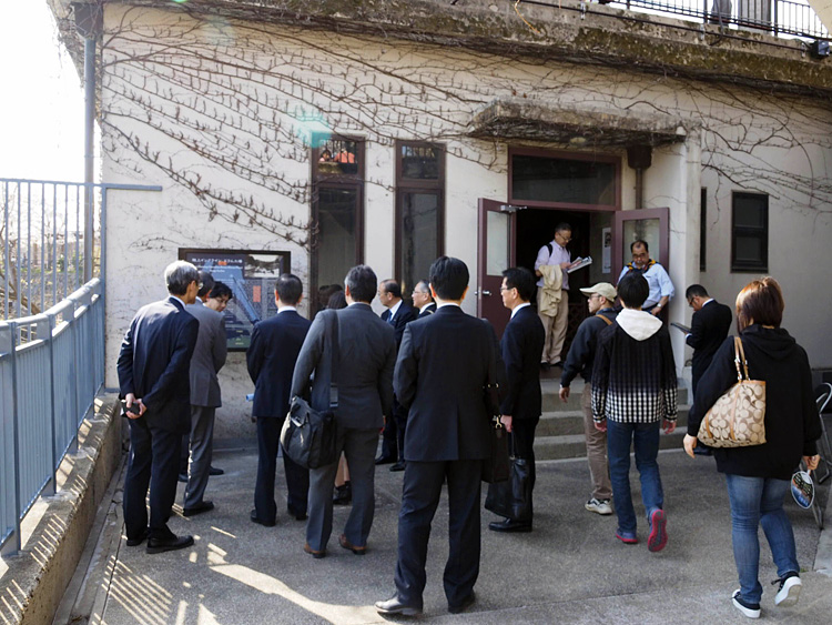 ドラム工場入口 entrance of the Drum Plant
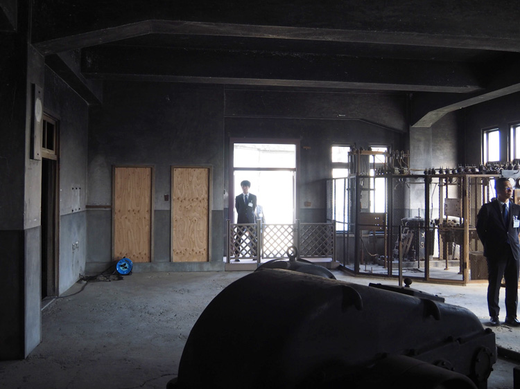 ドラム工場内から入口を見る。施設保護のため、一般観客は内部には入れない。View from the interior of the Drum Plant.
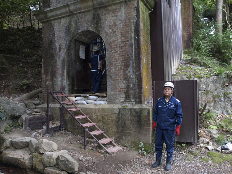 案内板設置前の水路閣調査 inspection before installation of the guide plate.